In ProMods 1.91, you have already seen what ProMods is capable of doing when it comes to landscaping. The ARP (Autobahn Rebuilding Project) is a clear example of how vastly different the map can become given enough time, assets and love (that last aspect is also very important, you know). Each version of ProMods builds upon the knowledge gained in the previous version and with our ever growing skills and team, we are able to excel ourselves in every successive version.
However, because implementing this stuff to our map takes time, not all areas are up to our standards. Scandinavia can use quite an overhaul, since the majority of this has not seen any significant updates since its first implementation in version 1.0. Merging ProMods with the DLC will help a great deal in this (this is the reason why we halted large-scale updates in that area). The UK and the rest of Germany also needs a huge overhaul. While Germany is being worked on in phase 2 of the ARP, we have to wait with the UK, since SCS is planning to do an expansion towards Ireland (of which no further details are known other than that it is definitely going to happen). Austria still needs rebuilding at several locations, as well as northern Italy, the Czech Republic and the SCS parts of France. But that is not the focus of today…
Today we are going to focus on the area that most ProMods mappers (five in total) call home: the Benelux. Benelux is a common abbreviation of “Belgium, the Netherlands and Luxemburg”, and thus it makes sense that this name is used for this project. Although some improvements have been made in this area in the past (the addition of Antwerpen and the E34 and E313, replacing at-grade crossings with interchanges in Rotterdam and Amsterdam) a lot is still misrepresented. The current map still contains, single-lane interchanges, at-grade crossings on motorways, an odd selection of represented motorways, space-consuming or missing river-crossings, and a-typical landscaping. For us, it was time to set things straight in our own home country, just like we did in Northwest Germany.
Below is a map of the Benelux representation in the current version of ProMods:
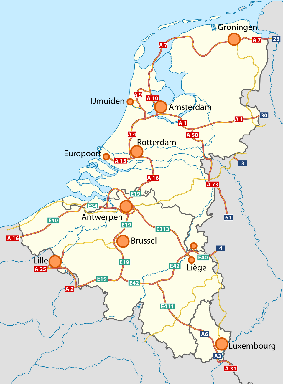
From this point of view, it doesn’t look like many things are wrong. However, there are a few things you may notice already, like roads crossing borders at odd locations (this is hard to correct and will probably not be corrected) or roads keeping the road number from the bordering country for too long and of course, the odd end of the BAB3, which just ends. What you can’t see is that the landscape around Antwerpen is too hilly, notable river crossings are missing (like the A1 crossing the IJssel at Deventer) the A10 ring around Amsterdam is far from realistic, the A1 is too curvy and the A9 is no motorway at all in any regard. Furthermore, the central and east of the Netherlands is quite empty and some back-bone transit routes are missing (the dutch A2 and A15, the Belgian E40 and the R0-East). In brief, there is enough wrong that we can consider a serious rebuild.
The next map will show our concept plan of this area. Bear in mind that this plan is still subject to change, but this will give you an impression of the general ideas behind the map project:
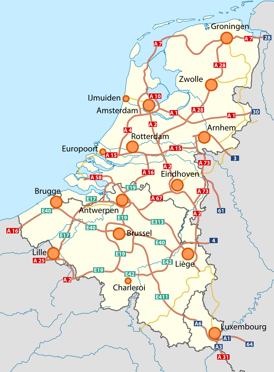
As you can see, there is a myriad of new motorways (so much, that we can seriously consider that this is overkill). A lot of important motorways have been added here, like the A2 and E40 (respectively the busiest motorway of the Netherlands and Belgium). The BAB3 doesn’t end anymore, but continues on the A12 to Arnhem. Luxembourg will get a connection to Germany for once and some borders will be shifted and rebuilt. A scienic route will be built from Rotterdam to Antwerpen covering the majestic Delta Works (and we seriously need some country roads in this urban area!)
Furthermore, you see that five cities have been added to the map: Arnhem (NL), Brugge (B), Charleroi (B), Eindhoven (NL) and Zwolle (NL). But that’s not all; Brussel and Amsterdam will be completely rebuild, both with a complete ring road allowing new connections to be made. Some of the areas we have already changed will be revisited too. Our opinion of our own work changes over time and what may seemed as a good idea back then may not be a good idea now.
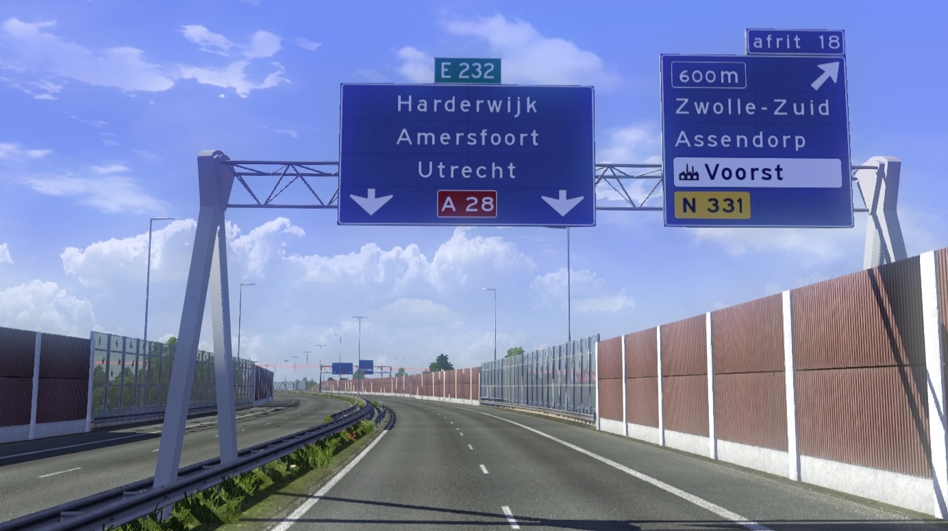
The development of the new areas also gives us the opportunity to implement new techniques and assets. The development is still on-going on that front. As an example, the new signage system is awaiting implementation in the Netherlands and Belgium. The assets for this are still not complete, but there is enough complete to give you a preview of what’s possible right now:
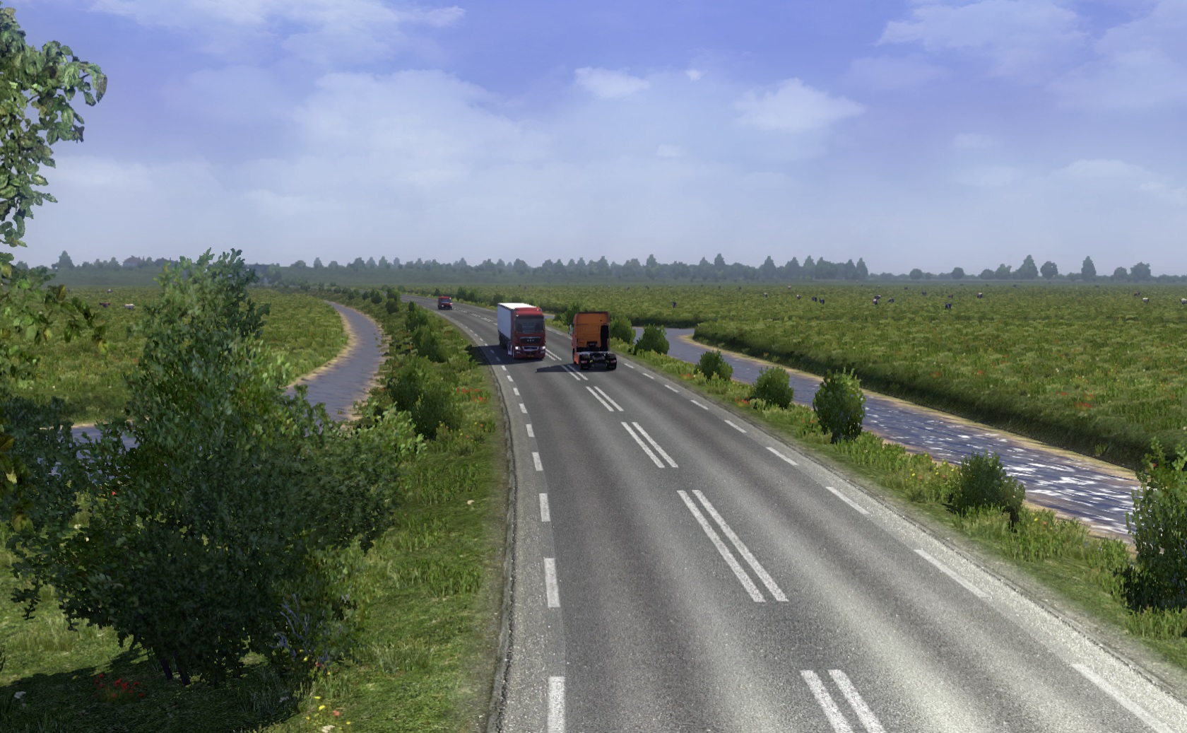
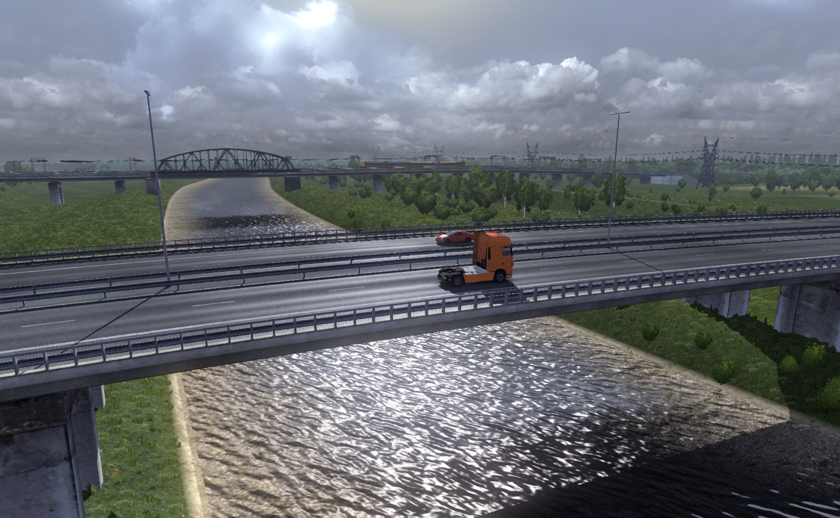
One of the cities that is currently nearing completion is Zwolle. Zwolle is the province capital of Overijssel and it’s one of the larger cities in the Netherlands and it’s located on what’s currently a big empty spot on the map. Zwolle is surrounded by something typical in the Netherlands that was missing in SCS’s interpretation of: polders. Polders are pieces of reclaimed land that are lower than the mean water level of the surrounding rivers, lakes or even the sea. In the Netherlands, these “pieces” can be huge chunks, as the whole province of Flevoland is basically three huge polders. Polders are characterised by the presence of dikes surrounding the polders, wide open landscapes and small drainage canals. This type of landscape can be found in the BRP east and north of Zwolle, as shown in the picture below:
Another aspect that was missing from the Netherlands are some important river crossings. Water plays a dominant role in the Dutch landscape; the Dutch have a love-hate relationship with water, so to say. In Zwolle, this aspect has been brought forward by including the IJssel crossing of the A28, giving an impressive and wide view over the river landscape:
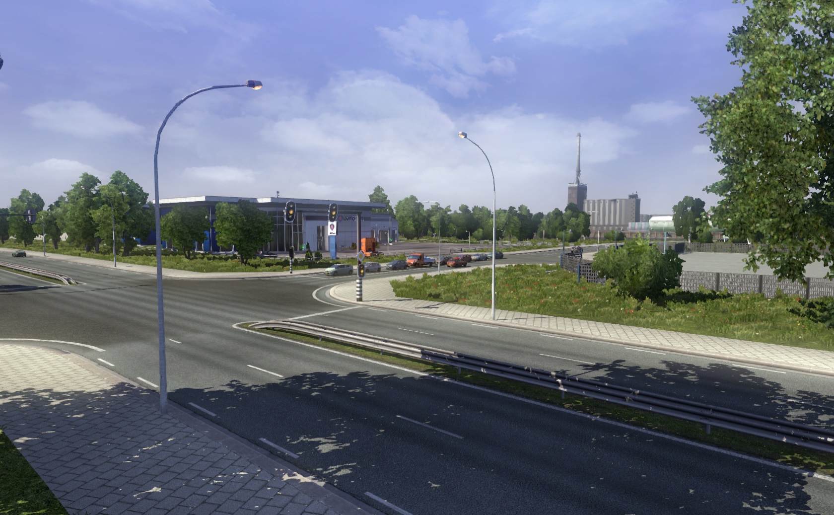
Finally, we will end this blog post with one more picture from an industrial area of Zwolle, Voorst. There are still a lot of small details missing (like signs), but the base is already pretty much complete.
So now you know more about our ambitions in this small, but urban part of Europe. There is still a lot more to do, and you can follow our developments in the Benelux Rebuilding Project topic on the forums.
MandelSoft
I’m Maarten, 25 years old and I'm a Dutch person living abroad in Prague [CZ]. For many years have a huge interest in infrastructure related subject and I can consider myself as a “road geek going professional”, especially after I completed my MSc. Transport & Planning in 2016. I’ve joined ProMods in 2013 and I’m currently Lead Developer. Besides mapping, I create a large part of the assets ProMods is using. My goal is to give our map that touch to make it more realistic and that people can recognise the places we map from real life. I work for SCS since November 2016 as map developer for Euro Truck Simulator 2, so you can say this became more than just a hobby. My other hobbies are drawing, geofiction and composing trance music (all of which are done with help of my computer).
InfidelFriese says:
I only see the same pictures of the map as Benelux is represented today in Promods.
Dyckert says:
Click on the picture and you see all changes, I didn’t see them either before i clicked it (on phone)
Marijn says:
Might I suggest to add Sittard in holland, they have DSM, Wich is big, lots of trucks move in and out everyday! 🙂
HiGuys says:
Yup, second map is exactly the first one, but is OK if you click on it.
Henning says:
Thanks for the hint – we published the same map twice by accident.
Now you can see our planned changes in the Benelux area in the BRP.
seanvdburg says:
This looks like a amazing project! However, please don’t forget about the unrealistic A7. The real A7 is heading more south, towards Heerenveen, instead of Leeuwarden. The A7 in the game looks similar to the real A31/N31. I’ve also been wondering why there is a curve in the Afsluitdijk, that’s not very realistic as well.
tkk7406 says:
Awesome plan!
ngaichun says:
Germany east reconstruction…..what time can complete?? Thanks
pieter1 says:
Kun je als het BeNeLux rebuilding project klaar is ook vrachten afleveren bij de Europoort?
M4rkus says:
Now that I see second picture, I must say that I like it. Crowded as it should be in the BeNeLux
Wamjo says:
That really looks cool. I can’t wait to play that it really looks great. I studied about polders in my Geography and the Zuider Zee and Delta works, and yet when i first played the game there were no Polders in Netherlands. It’s really good that you are bringing them. What about some sand dunes along the coast because I was taught they also work as a barrier in case water level is rising.
christophebruneel says:
Suggestion: ferry transport Oostende-Dover?
Tiger1dude. says:
Will Ghent be added too?